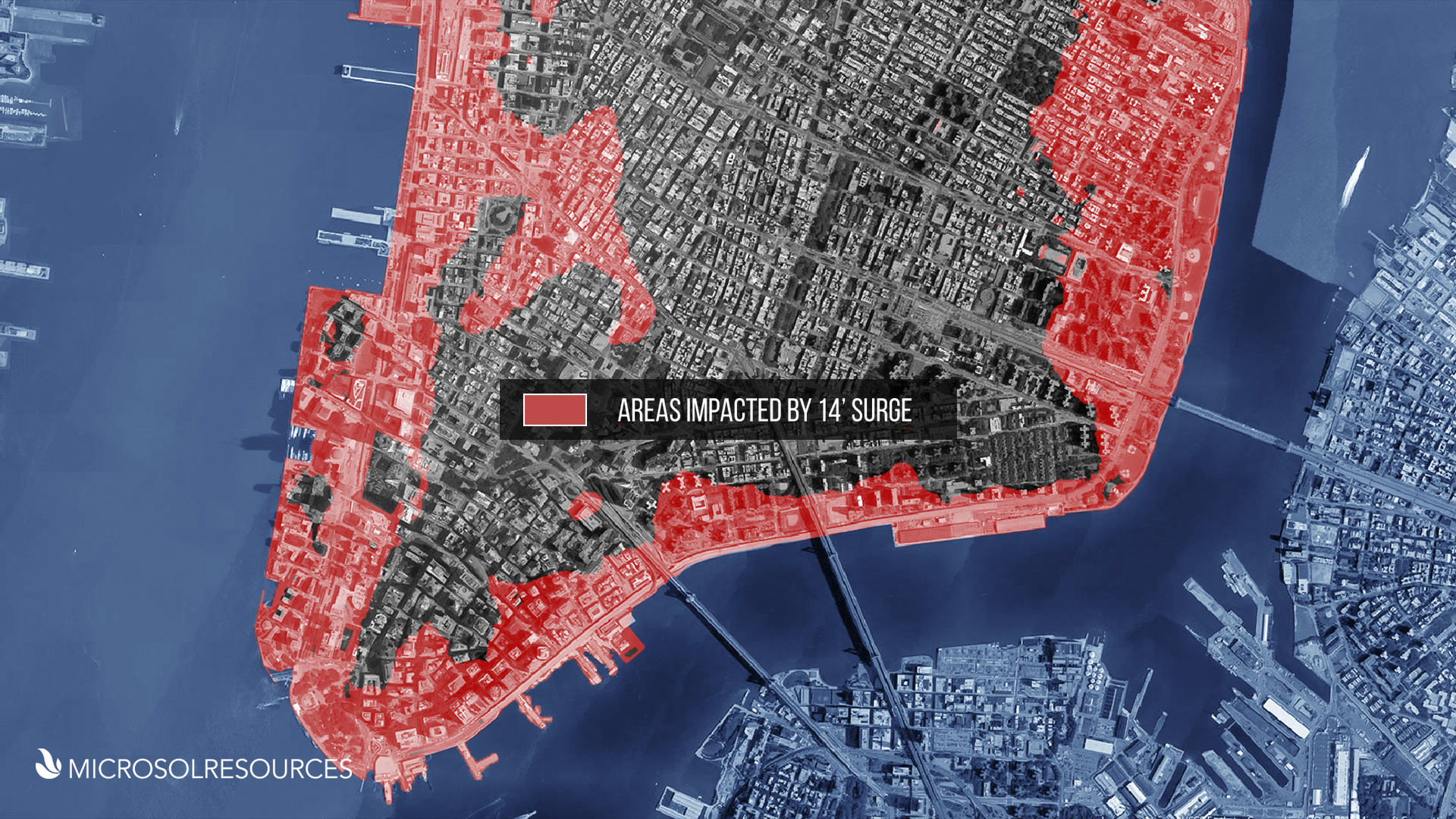
In my previous blog, we saw how we could use Project Boulder for Infraworks 360 to simulate a storm surge similar to the one experienced during Hurricane Sandy and observe its effects on Lower Manhattan. What if we now wanted to start conceptualizing ideas for designing a system to protect the areas most affected by the storm surge? How would we approach that design process and how could we communicate it effectively?
For those of you who love experimenting with technology, Project Boulder for InfraWorks 360 is available on Autodesk Labs, giving you the ability to create two-dimensional (2D) flood simulations alongside your immersive Infraworks 360 models. The video posted by Autodesk demonstrating the preview is definitely informative, but the dataset isn’t useful for seeing how this technology preview could be used in an urban environment. Being a New Yorker, I knew exactly the data set I wanted to use, but to test out the software I needed to come up with a scenario that could not only show Project Boulder in action but also tie-in the simulation with something quantifiable. After mulling it over, I came up with the overzealous idea of modelling Hurricane Sandy! (more…)
Features the latest informative and technical content provided by our industry experts for designers, engineers, and construction firms and facility owners.