


The Modern Drainage Design Toolkit
By Microsol Resources, Graitec Group | Infrastructure, Sustainability
If you are a design engineer or plan reviewer who works on stormwater conveyance systems, then you understand the difficulty and inefficiency that come from working with separate or outdated tools. Securing approvals for any land development is dependent on meeting regulatory requirements. These requirements are easy to miss as rules evolve and multiple stakeholders become involved.
If your design process is slow, error-prone, and not conducive to quick review and approval, the reality is your firm is likely losing projects.
The good news is that design and simulation software is evolving to the point where having a modern technology stack will help you design more quickly, and more accurately, and secure approval in an expedited manner.

Bringing Together Computer-Aided Design (CAD) and Simulation
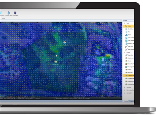
For many firms – especially smaller ones – working between multiple data sources, design tools, calculators, and spreadsheets is a slower, and error-prone process. When working on a tight timeline, these issues can erode the competitive edge you have when bidding on projects. One big way to reduce these inefficiencies is to work in an integrated platform that is intuitive and easy to use.
By importing data from multiple sources – such as CAD, GIS, and Aerials – and having hydrology, hydraulics, inlet capacity, and spread all in a single environment, you can get a working model up and running with your required results easy to access. This helps streamline the design process instead of doing the work in separate places.
By running everything in a single platform with CAD, GIS, and aerial photos for context, you can easily understand if the facilities you are designing will appropriately convey flow for the range of required storm events.
Exporting CAD and LandXML files from the software is key to preventing any errors that might occur during the transfer of data from a software package to a set of design plans. By exporting these files, much of the line work and labeling is complete and can provide the basis of what is needed for a grading plan.
Reworking designs is costly, so more work that can be done to ensure a successful design during the design process will only help by providing an accurate design the first time around.
Design, Simulate and Compare – All in One Place
Changes to the site plan happen which makes it important to be able to quickly update a drainage plan, deploy alternative scenarios, and see the level of impact it will have on the site development plan.
When starting off a drainage plan, the first thing you want to know is where the water is already flowing. By easily visualizing a deluge, you can quickly get an idea of where water will naturally flow on a site to efficiently lay out your system. Along with simple calculators for accurate and efficient BMP sizing, you can be sure you’ll limit the amount of grading that’s needed on-site.
In a perfect world, all models would be accurate the first time around, however, that is usually not the case. To avoid the frustration of unexpected “surprises” and mistakes at the end of a model build it is useful to use a solution that allows for Validation. That way, you can quickly identify the areas in which you might have made a mistake and evaluate suggestions on how to fix it.
Easy Visualization Simplifies Non-Technical Review
The goal of any model is to ultimately get work reviewed, approved, and put into a project. The more that your designs are ‘true-to-site’ the better off you will be throughout this entire process.
When the time comes to present a proposed development to improve an existing site, it is especially critical that:
- The design meets all regulations and requirements,
- It clearly demonstrates the improved recommendations, for the applicable storm events, and
- It is easily understood by non-technical stakeholders
Being able to minimize the error by exporting the linework, labels, and other plan information – as well as having built-in validation – ensures that the design will meet regulatory requirements. This only increases the chances that a design is accepted and project-ready. If you’re using a modern drainage design technology toolkit, then you could be going from a blank slate to a set of design plans in just 30 minutes!
Want to know more about InfoDrainage?
Please contact us at info@microsolresources.com for more information.
INDUSTRIES: Water Industry