


Tips for Stack Plan & Floor Plans
By Anna Liza Montenegro | Surveying
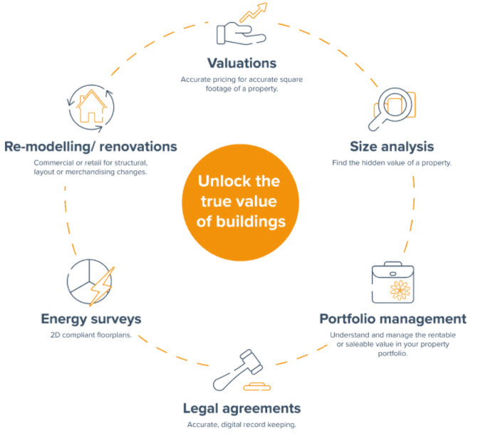
Stack planning is a valuable tool in predicting how changes to one area of the workplace affect others. Stack planning helps facility managers (FMs) determine if a change is needed, and if so, where. It’s the most holistic way of looking at facilities and everything within them.
Stack planning is a macro way of looking at space utilization. The “stack” is a complete collection of floor plans, showing every level of a building and each floor’s distinct features. A stack shows which groups occupy what space, where open spaces are, and floor plan capacities.
Why do you need floorplans for stack planning?
Goal stack planning involves quickly rearranging large employee groups to better utilize existing space. A facility manager might use stack planning to rearrange entire departments across three floors of a building or model workspace conservation under a new desking arrangement.
The need for fast accurate floorplans, a large portfolio of assets to be constantly maintained and the ownership data that is collected from the assets all drive a requirement for technology and digitization of the processes.
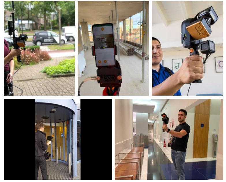
Being able to generate floorplans quickly, easily and with no requirement for trained professionals, is now a reality with our handheld laser scanners. Automation using the new GeoSLAM Connect Platform makes generating floorplans an easy and risk-free exercise.
The way we understand buildings is changing.
The digitalization of buildings is here, and it’s set to revolutionize the way we understand our spaces. Use GeoSLAM Floorplans for the rapid and automatic creation of 2D floorplans using mobile LiDAR and analytics.
What are the benefits of using GeoSLAM to create floorplans?
- No specialist outsourced data collectors required, with a few minutes of training your team will be able to capture quality data
- Not reliant on photogrammetry where large spaces or multiple floors can’t be captured, and where mistakes are common
- You own 100% of the data, always. We don’t have access to your data for machine learning
- You can choose where you want the floorplans to be stored, making it easier to collaborate with colleagues
- Choose to integrate photos, notes, or voice notes into your data
- Reliable hardware and automated data processing, backed up by GeoSLAM Care
“We discovered 240,000 additional square feet in a 12 million square foot portfolio using GeoSLAM.”
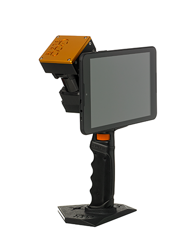
Which scanner is best for digitizing floorplans?
Each one of the following GeoSLAM laser scanners collects data with high speed and precision, and pairs with GeoSLAM’s Draw BIM software.
Check out the differences to fit the scanner for your own project needs.
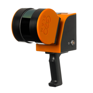
If you’re looking for a reliable way to map and understand spaces, check out the ZEB Go. Whether it’s the first time you’ve looked at digital surveying, or you want each of your sites equipped with the smartest SLAM, the ZEB Go is the place to start.
ZEB Revo RT is a unique, lightweight revolving laser-scanner that allows you to scan and process simultaneously, as you walk. Handheld, pole-mounted, or attached to your chosen mobile platform such as a vehicle or UAV and pass through your target survey environment to record more than 40,000 measurement points/second.
With a range of 100m, the ZEB Horizon 3D mobile scanner is great for outdoor use, yet its lightweight and compact design also makes it perfect for indoor surveys.
Summary
Whether you’re thinking about moving or renovating, you would want to get point cloud data from each floor using 3D laser scanning. This will help the design and facilities team with onsite conditions and improve the project accuracy and quality.
If you have additional questions on how to get started, feel free to contact us at geoslam@microsolreosurces.com.
Interested in surveying and data capture into a 3D model or 2D drawing, so you can start your design with accurate dimensions?
INDUSTRIES: Architecture, Buildings, Construction, MEP Engineering, Structural Engineering